Garmin ECHOMAP™ Ultra 125sv with GT56UHD-TM Transducer - 010-02528-70
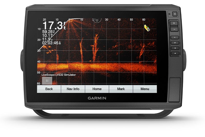
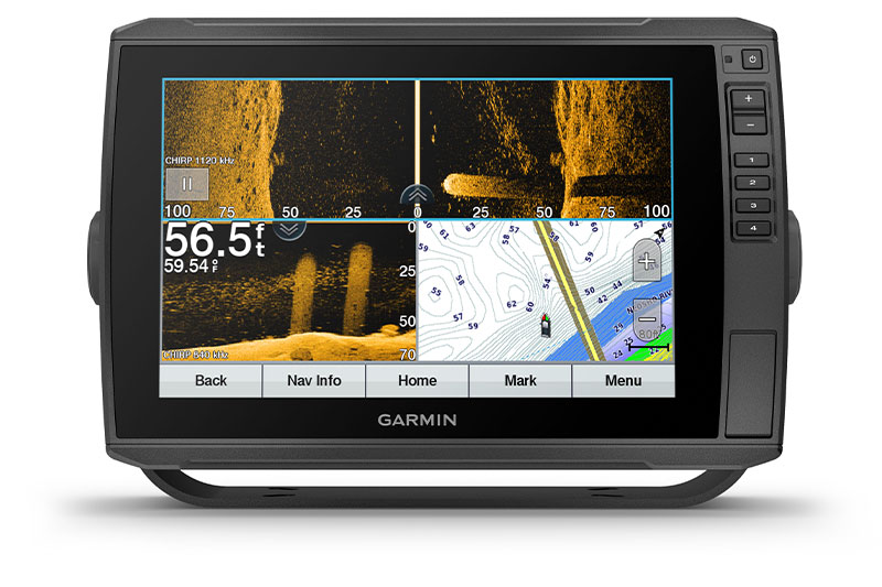
LIVESCOPE™ SONAR SUPPORT
ECHOMAP Ultra 125sv supports a variety of Garmin transducers, including Panoptix™ all-seeing sonar transducers and the Panoptix LiveScope™ LVS12 scanning sonar system (sold separately).
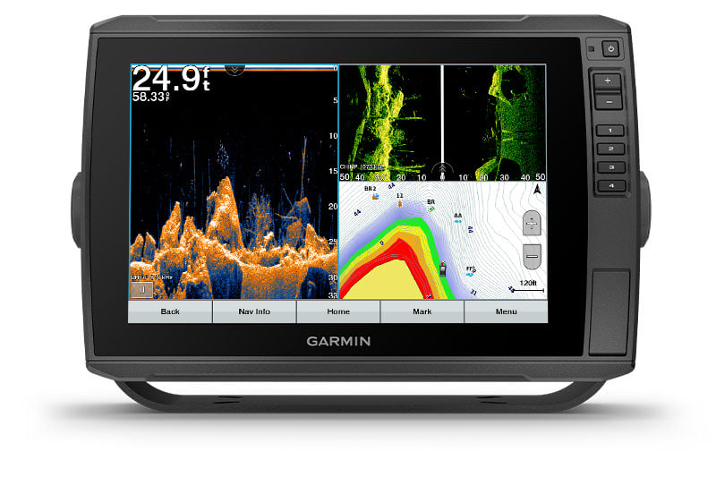
BUILT-IN UHD SONAR
The included GT56 transducer provides Garmin CHIRP traditional sonar and Ultra High-Definition ClearVü and SideVü scanning sonars. With three scanning sonar frequencies and 20% greater range for our UHD SideVü sonar, you’ll get top performance at all depths.
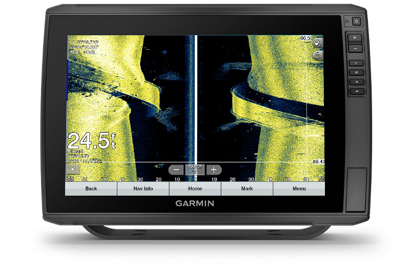
VIVID COLOUR PALETTES
High-contrast vivid scanning sonar colour palettes make it easier than ever to distinguish targets and structure.
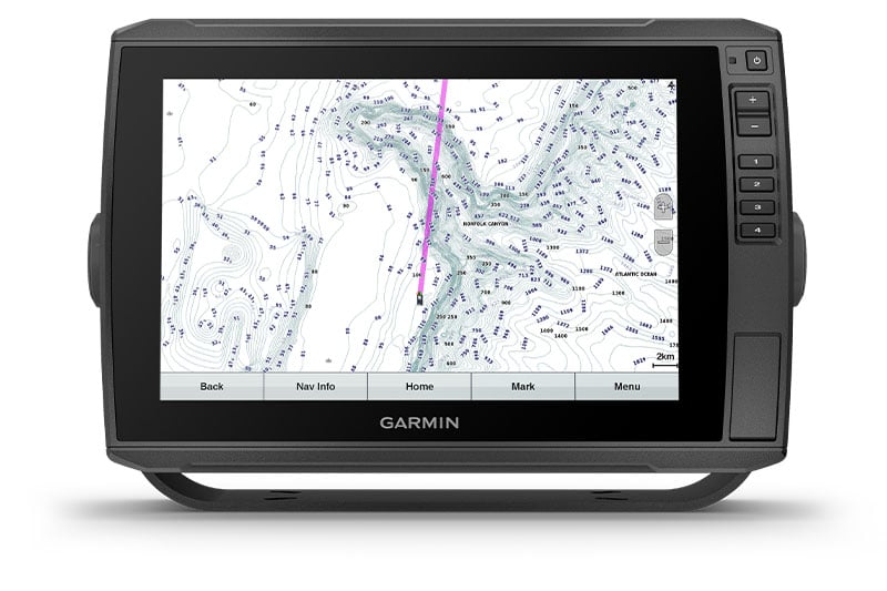
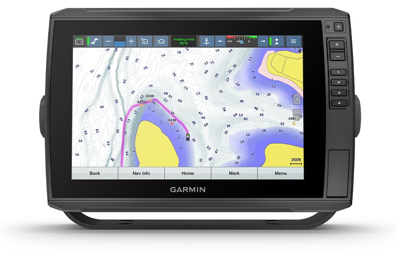
PRELOADED CHARTS
Experience unparalleled coverage and detail with BlueChart g3 Australia and New Zealand coastal charts with integrated Navionics® data and Auto Guidance2 technology.
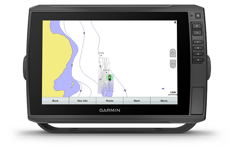
QUICKDRAW CONTOURS
Create personalised fishing maps on-screen with 1’ contours. Keep the data to yourself, or share it with the Garmin Quickdraw™ Community on the Garmin Connect™ app3.

Stay connected on and off the water.
NETWORK CAPABLE
If you have multiple compatible ECHOMAP Ultra 10″ and 12″ units or ECHOMAP Plus or UHD 7″ and 9″ units on your boat, you can share information — such as sonar, user data and charts — among them.
NMEA 2000® NETWORK COMPATIBILITY
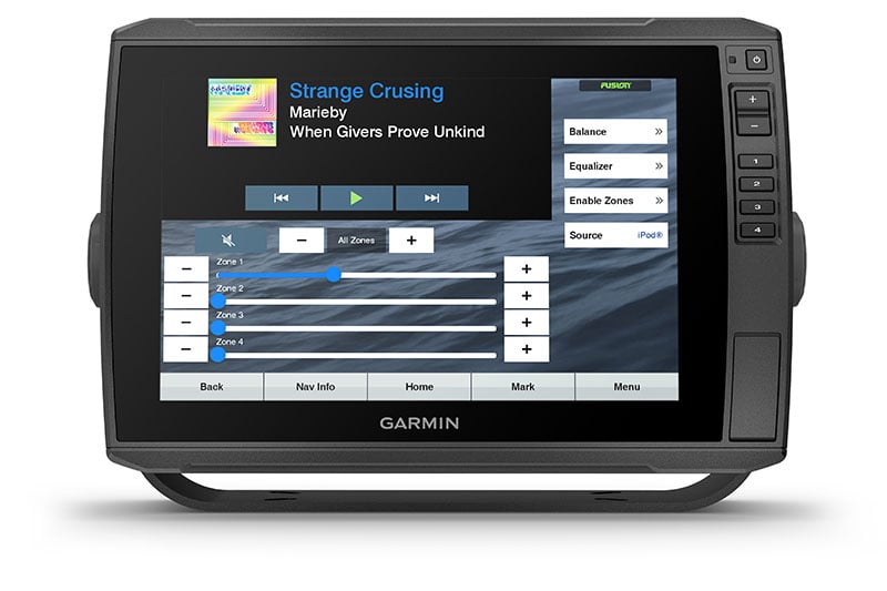
Connect to your compatible autopilots, digital switching, weather, Fusion-Link™ audio system, media, VHF, AIS, engine data, heading sensors — such as the SteadyCast™ sensor — and more from one screen.
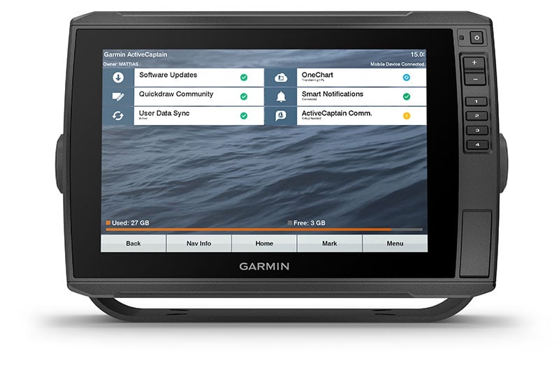
ACTIVECAPTAIN APP
Built-in Wi-Fi® connectivity pairs with the free all-in-one mobile app for access to the OneChart™ feature, smart notifications, software updates, Garmin QuickDraw Community data and more1.
FORCE™ TROLLING MOTOR COMPATIBILITY
Take control of the most powerful and efficient trolling motor available4, route it to waypoints, follow tracks and more from the screen of your chartplotter.
TAKE IT WITH YOU
Keep your ECHOMAP Ultra safe and secure. Cords plug directly into the quick-disconnect bail mount, which allows you to quickly install and remove your unit.
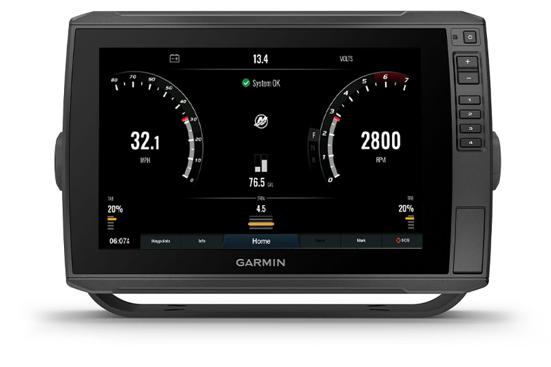
ENGINE CONNECTIVITY
Connect this chartplotter to different kinds of engines — including select Mercury and Yamaha® models — to see RPMs, fuel flow, temperature, trim and other important information at a glance. You may need additional hardware, so be sure to check with your engine manufacturer.
Physical & Performance
| Display size |
10.3” x 6.4”; 12.1" diagonal (26.1 cm x 16.3 cm; 30.7 cm diagonal) |
| Display resolution |
1280 x 800 pixels |
| Physical dimensions |
13.4" x 9.0" x 3.9" (341 x 229 x 98 mm) |
| Receiver |
10 Hz
|
| Water rating |
IPX7
|
| Weight |
5.5 lbs (2.5 kg)
|
| Mounting options |
Bail or flush |
| Display type |
WXGA IPS display |
| Antenna |
Internal or external over NMEA 2000 |
Maps & Navigation
| Routes |
100 |
| Track log |
50,000 points; 50 saved tracks |
| Preloaded maps |
BlueChart® g2
|
| Accepts data cards |
2 microSD™ cards
|
Features
| ClearVü |
Yes with CHIRP (built-in)
|
| Waypoints |
5,000
|
| Wireless connectivity |
Yes
|
| Transmit power |
600 W (RMS) / 4,000 W (peak to peak) |
| NMEA 0183 compatible |
Yes |
| Water temperature log and graph |
Yes |
| GCV™ Black Box sonar support |
Yes |
| Wireless mouse compatible |
No |
| NMEA 0183 input ports |
1
|
| Dual-beam (77/200 kHz) sonar capable |
Yes |
| Supports DSC (displays position data from DSC-capable VHF radio) |
Yes |
| NMEA 2000® compatible |
Yes |
| ActiveCaptain compatible |
yes
|
| Supports AIS (tracks target ships position) |
Yes |
| Sonar recording |
Yes |
| Polarised Support |
Yes |
| Garmin Meteor™ Audio System compatible |
No |
| Garmin Marine Network™ ports |
2 (large connector)
|
| Garmin Sonar compatible |
Yes |
| Frequencies supported |
- CHIRP High-Wide: 150-240 kHz
- Ultra High-definition ClearVü: 800 kHz (760-880 kHz)
- CHIRP ClearVü: 455 kHz (425-845 kHz)
- Ultra High-definition SideVü: 1,200 kHz (1060-1170 kHz)
|
| GSD™ Black Box sonar support |
No |
| Sonar history rewind |
Yes |
| Garmin SmartMode compatible (customizable monitor presets) |
No |
| Wireless remote compatible |
No |
| Supports FUSION-Link™ compatible radios |
Yes |
| Maximum depth |
2,300 ft @ 77 kHz, freshwater
1,100 ft @ 77 kHz, saltwater
(depth capacity is dependent on water bottom type and other water conditions)
|
| Dual-frequency (50/200 kHz) sonar capable |
Yes |
| Transducer pin numbers |
1 – LVS sonar, 1 – 12 pin scanning sonar |
| Bottom lock (shows return from the bottom up) |
Yes |
| NMEA 0183 output ports |
1
|
| Tide tables |
Yes |
| SiriusXM™ Weather & Radio compatible |
No |
| Power consumption |
26 W
|
| Garmin Radar compatible |
No |
- ECHOMAP Ultra 125sv with BlueChart g2 for Australia/New Zealand
- GT56UHD-TM transducer
- Power/data cable
- Tilt mount with quick release cradle
- Flush mount
- Protective cover
- Hardware
- Documentation
Videos